Thursday, June 22, 2017

The End


The Kind Room

What a wonderful name, great service an awesome bud. I got Durban Poison, Silver Pearl and some kief.
Noel a budtender at The Kind Room


Denver II

I went to see the Mummy in 98 degree heat. The movie was good trash and the A/C worked well.
My fit back together with Mohammad by cab driver friend. It was good to see a friendly face.
I moved on to used by free night to the Radisson Central hotel way too far out of the way. Nothing near here but I don't care as I am tied and it is too hot. I did get to see a movie as the free shuttle took me into town. The movie was about Tupac, All Eyes on Me and it was good


On the Road to Denver

My drive to Denver would be about 7 hours. I left early and the drive was especially wonderful when I hit Colorado. I had enough of the dry, red sandstone of the Southwest.
My first two night were at the Embassy Suites which was a nice central,hotel with terrible wifi in the bedroom but great in living room.


Drive to Moab

The weather is climbing the high 90's. The drive about 3 hours with stops along with the heat seems to have zapped my energy. I am here at the Holiday Inn Express Moab.

I realize I like Holiday Inn Express better than Hampton Inn

Here is the pool which I never go in...Oh well

Wednesday, June 21, 2017

Durango Train II

Here I am getting ready to hold up the train


Durango Steam Train...

The Durango to Dilverton train is supposed to Mr one of the great rail journeys in North American. While is was nice to board a vintage, steam engine train and sit in the orgrinal parlor car, I was not ohhh and ahhh all over the place and at $234 it is not cheap for a 3 1/2 hour journey.


Friday, June 16, 2017

Cliff Palace II...


Cliff Palace....

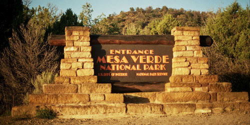
I had an 11 am tour time for Cliff Palace.  The drive from the hotel is about hour to an hour an a half.
I had an excellent breakfast at the diner and began my journey.  The drive to the National Park was quick but the winding road to the sight took most of the time.

I got there about 10:15, went to the bathroom and read on my kindle. The tour Ranger gave an good introduction and we were off. There were some stairs while going up was no problem  but due to my dept perception issues I took it slow. At one point, I felt a younger man's hand  on my arm helping me. I tried not to feel too embarrassed but was grateful for the help. The average person even older individual without health issues would have no problem. There were two ten foot sturdy ladders to climb to get to the cliff dwelling.  At some sections, they have hand railing which were great. I can't understand site that welcome millions of tourists but do not wish to provide any type railing due to the historic nature of the sight.
This dwelling as I hope the pictures capture is one of my favorite sights in America. You actually saw how the people here built houses with different room and even religious places to storytelling and worship called Kivas.


Cliff Palace History...

Cliff Palace is the largest cliff dwelling in North America. The structure built by the Ancestral Puebloans is located in Mesa Verde National Park in their former homeland region. The cliff dwelling and park are in the southwestern corner of Colorado, in the Southwestern United States.

Tree-ring dating indicates that construction and refurbishing of Cliff Palace was continuous approximately from 1190 CEthrough 1260 CE, although the major portion of the building was done within a 20-year time span. The Ancestral Pueblo that constructed this cliff dwelling and the others like it at Mesa Verde were driven to these defensible positions by "increasing competition amidst changing climatic conditions".[1] Cliff Palace was abandoned by 1300, and while debate remains as to the causes of this, some believe that a series of megadroughts interrupting food production systems is the main cause. Cliff Palace was rediscovered in 1888 by Richard Wetherill and Charlie Mason while out looking for stray cattle. 

Cliff Palace was constructed primarily out of sandstone, mortar and wooden beams. The sandstone was shaped using harder stones, and a mortar of soil, water and ash was used to hold everything together. "Chinking" stones were placed within the mortar to fill gaps and provide stability. 

Anasazi History.....

The Anasazi (also known under the wider descriptor Ancestral Puebloans), were a culture of Native Americans that inhabited the Four Corners region of Utah, Colorado, Arizona and New Mexico from about 1 A.D. to 1300 A.D. However, depending on where you draw the line on what separates the Anasazi from earlier groups that inhabited the region, the start date may go back as far as 1500 B.C. The Anasazi are known best for their development of a sedentary lifestyle vs. the hunter/gatherer life of past groups. They engaged heavily in agriculture (growing beans, squash and corn), and developed monumental architecture to house their families, provide a defense against hostile neighbors, and to protect their food supply from rodents and other animals.
Research also suggests they were loosely related to other native cultural groups that inhabited the area during the same period, including the Fremont, Mogollon, and Hohokam. Modern Puebloan tribes, such as the Zuni, Hopi, Keres and Towa count these three four Ancestral Puebloans groups among their kin.


Anasazi as a cultural label

The term "Anasazi" was established in archaeological terminology through the Pecos Classification system in 1927. It had been adopted from the Navajo. Archaeologist Linda Cordell discussed the word's etymology and use:
The name "Anasazi" has come to mean "ancient people," although the word itself is Navajo, meaning "enemy ancestors." [The Navajo word is anaasází (<anaa- "enemy", sází "ancestor").] The term was first applied to ruins of the Mesa Verde by Richard Wetherill, a rancher and trader who, in 1888–1889, was the first Anglo-American to explore the sites in that area. Wetherill knew and worked with Navajos and understood what the word meant. The name was further sanctioned in archaeology when it was adopted by Alfred V. Kidder, the acknowledged dean of Southwestern Archaeology. Kidder felt that it was less cumbersome than a more technical term he might have used. Subsequently some archaeologists who would try to change the term have worried that because the Pueblos speak different languages, there are different words for "ancestor," and using one might be offensive to people speaking other languages.[32]
Many contemporary Pueblo peoples object to the use of the term Anasazi; controversy exists among them on a native alternative. Some modern descendants of this culture often choose to use the term "Ancestral Pueblo" peoples. Contemporary Hopi use the word Hisatsinom in preference to Anasazi.[

Mesa Verde National Park History

Mesa Verde National Park is a National Park and World Heritage Site located in Montezuma County, Colorado. It protects some of the best preserved Ancestral Puebloan archaeological sites in the United States.
Created by President Theodore Roosevelt in 1906, the park occupies 52,485 acres (21,240 ha) near the Four Corners region of the American Southwest. With more than 4,300 sites, including 600 cliff dwellings, it is the largest archaeological preserve in the U.S. Mesa Verde (Spanish for "green table") is best known for structures such as Cliff Palace, thought to be the largest cliff dwelling in North America.
Starting c. 7500 BCE, Mesa Verde was seasonally inhabited by a group of nomadic Paleo-Indians known as the Foothills Mountain Complex. The variety of projectile points found in the region indicates they were influenced by surrounding areas, including the Great Basin, the San Juan Basin, and the Rio Grande Valley. Later, Archaic people established semi-permanent rockshelters in and around the mesa. By 1000 BCE, the Basketmaker culture emerged from the local Archaic population, and by 750 CE the Ancestral Puebloans had developed from the Basketmaker culture.
The Mesa Verdeans survived using a combination of hunting, gathering, and subsistence farming of crops such as corn, beans, and squash. They built the mesa's first pueblos sometime after 650, and by the end of the 12th century, they began to construct the massive cliff dwellings for which the park is best known. By 1285, following a period of social and environmental instability driven by a series of severe and prolonged droughts, they abandoned the area and moved south to locations in Arizona and New Mexico, including Rio ChamaPajarito Plateau, and Santa Fe.

Thursday, June 15, 2017

San Juan Parkway Drive

  I was on my way after an early hearty breakfast. I drove the San Juan Skyway from Cortez to Telluride. The drive was lovely but would be better in th fall. I stopped in Telluride got me some Starbucks and drove back to Cortez.
On the way back, I stopped at the Anasazi Heritage Center and Museum. I enjoy a quick look at he Museum with artifacts going back to 6000 BC. I bought a National Parks game for the girls for when we go in July. I was glad when I received information to stop into the Welcome Center in Cortez and pick up tickets for the Cliff Palace Visit. When I got to the welcome center this guy informed me I left my Credit Card at the Museum. He seem to take a perverse delight in telling me "Have a nice ride back there" ASSHAT!  I was glad to get my ticket and information that the drive would be about an hour-and-a-half.


Not feeling well...

After 3 days of 10 hour a day scenic driving, I was so exhausted. I decided to do nothing today. I went into town for some food and visited Live Well  a 420 shop on Main Street. I picked up an eight of Bay Dream, we shall see. It was one of those days whete you wonder why you are traveling alone in a place where you do not know anyone. I was happy to do nothing but read, watch news, relax and eat.

Cortez and Hampton Inn

I finally made it to the Cortez Hampton for 5 nights without paying a dime...All on points!
I was given a suite or what acts as a Hampton Suite...A kind bed, couch, desk and big TV.


Long drive II


The long, long drive

Wow, this was another long day of driving over 10 hours! I check out of the Holiday inn with a plan to follow the scenic byway Rt 89 thought Utah and Arizona skirting the Grand Canyon, Marble Canyon and Monument Valley.


Zion National Park History...

Zion National Park is located in the Southwestern United States, near Springdale, Utah. A prominent feature of the 229-square-mile (590 km2) park is Zion Canyon, which is 15 miles (24 km) long and up to half a mile (800 m) deep, cut through the reddish and tan-colored Navajo Sandstone by the North Fork of the Virgin River. The lowest elevation is 3,666 ft (1,117 m) at Coalpits Wash and the highest elevation is 8,726 ft (2,660 m) at Horse Ranch Mountain. Located at the junction of the Colorado PlateauGreat Basin, and Mojave Desert regions, the park's unique geography and variety of life zones allow for unusual plant and animal diversity. Numerous plant species as well as 289 species of birds, 75 mammals (including 19 species of bat), and 32 reptiles inhabit the park's four life zones: desertriparianwoodland, and coniferous forest. Zion National Park includes mountainscanyonsbuttesmesasmonolithsriversslot canyons, and natural arches.

Human habitation of the area started about 8,000 years ago with small family groups of Native Americans; the semi-nomadic BasketmakerAnasazi (300 CE) stem from one of these groups. In turn, the Virgin Anasaziculture (500 CE) developed as the Basketmakers settled in permanent communities.[4] A different group, the Parowan Fremont, lived in the area as well. Both groups moved away by 1300 and were replaced by the Parrusits and several other Southern Paiute subtribes. Mormons came into the area in 1858 and settled there in the early 1860s. In 1909 the President of the United StatesWilliam Howard Taft, named the area a National Monument to protect the canyon, under the name of Mukuntuweap National Monument. In 1918, however, the acting director of the newly created National Park Service changed the park's name to Zion, the name used by the Mormons. According to historian Hal Rothman: "The name change played to a prevalent bias of the time. Many believed that Spanish and Indian names would deter visitors who, if they could not pronounce the name of a place, might not bother to visit it. The new name, Zion, had greater appeal to an ethnocentric audience."[5] The United States Congressestablished the monument as a National Park on November 19, 1919. The Kolob section was proclaimed a separate Zion National Monument in 1937, but was incorporated into the park in 1956.

The geology of the Zion and Kolob canyons area includes nine formationsthat together represent 150 million years of mostly Mesozoic-aged sedimentation. At various periods in that time warm, shallow seas, streams, ponds and lakes, vast deserts, and dry near-shore environments covered the area. Uplift associated with the creation of the Colorado Plateaus lifted the region 10,000 feet (3,000 m) starting 13 million years ago.[6]


Zion II


Zion National Park

The drive to Zion is along route 9.  I have a senior pass and did not have to pay the fee to enter. Route 9 is beautiful as it goes through the park with spring red rock cliffs which make it difficult to keep your eye on the road.  The visit to the Grand Staircase is part if this drive.
A funny thing happened as I was driving I thought I was on a certain road but when I came out of the park I was totally lost and had turned wrong somewhere.